REDONDA PROJECT, BRITISH COLUMBIA, CANADA
Project Overview
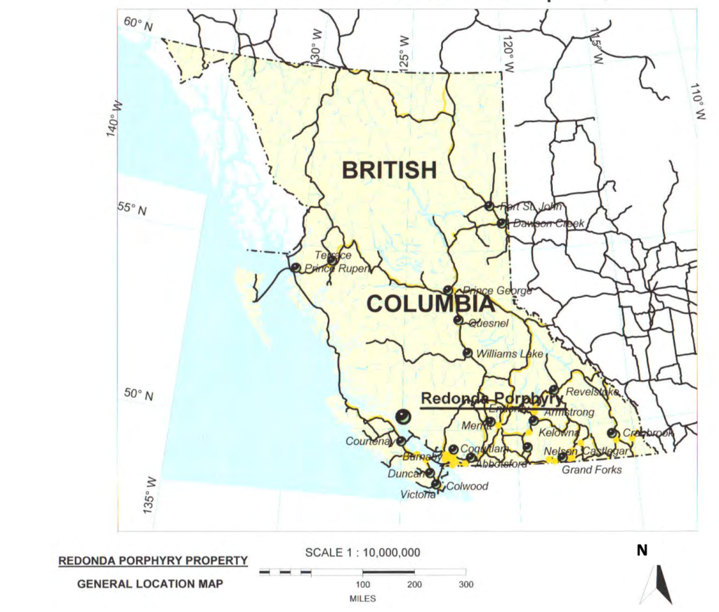
Stamper has exclusive right and option to acquire 100% of the Optionor’s interest in the Redonda property, subject to the NSR in favour of the Optionor. The Redonda project consists of 9 mining claim units located northeast of Campbell River, in the Vancouver Mining Division of British Columbia.
The Redonda Porphyry Prospect is an underexplored porphyry copper- molybdenum occurrence located in the northern Gulf Islands between the Wrangellia Terrain of Vancouver Island and the Coast Plutonic Belt of the mainland.
Project Overview
Location
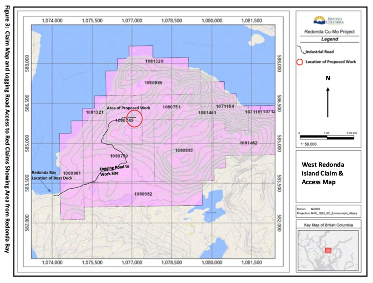
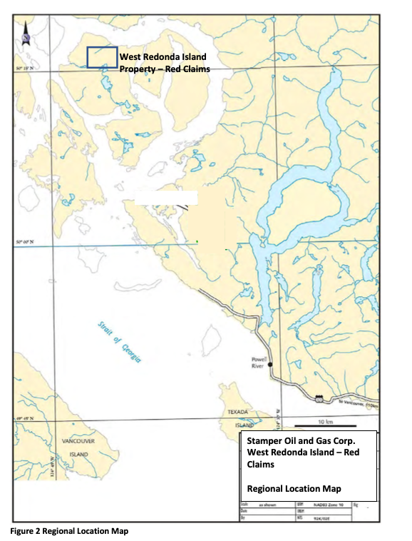
The Redonda Porphyry Prospect is located in the northern Gulf Islands between the Wrangellia Terrain of Vancouver Island and the Coast Plutonic Belt of the mainland. The Redonda claim group (the property) is comprised of 14 contiguous claims called Red 1 to 9, Redonda, Redonda 2 and 7 and the Gloucester 1 and 2 located on West Redonda Island east of Campbell River (Figure 1 and 2). The claims cover 2,746.46 hectares of copper and molybdenum mineralization. The Redonda property is located on NTS map sheet 92 K/7W as well as BCGS maps sheet 092K026 in the Vancouver Mining Division in British Columbia, Canada.
The claims are accessed from Campbell River BC via helicopter or boat. A network of reclaimed logging roads criss-crosses the property. The OK Claims shown on Figures 2 and 3 are owned by other entities and provide perspective on proximity to Powell River. The OK Property is also a significant porphyry style showing owned by others located in plutonic rocks east of the Coast Suture Zone. More detail is provided in Figure 4.
Regional Geology
The regional setting of the Redonda property is part of the Coast Suture Zone, as most of the known porphyry copper-molybdenum deposits in the Canadian Cordillera are situated in the Intermontane Superterrane east of the Coast Plutonic Complex and to a lesser degree in the Insular Superterrane to the west.
Mineralization
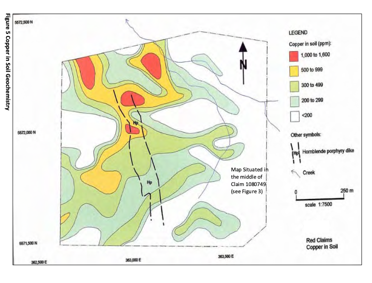
In the claims area, Early Cretaceous dioritic intrusive rocks of the Coast Plutonic Complex have been intruded by at least three later intrusive units, including a quartz porphyry plug, a 60 to 90 meters wide hornblende porphyry dike which is locally brecciated over its 650 meters exposed length and several smaller feldspar porphyry dikes which cut dioritic rocks near the southwest margin of the hornblende porphyry dike. Higher concentrations of copper-molybdenum mineralization are closely associated with the hornblende porphyry dike, particularly in areas where it has been brecciated. The geological setting of the mineralization on the Red mineral claims share a number of features similar to those observed at the OK over copper-molybdenum porphyry deposit located 34 km to the southeast, north of Powell River and the Gambier Copper deposit in Howe Sound.
Compilation of trench and diamond drill hole assay results has identified a porphyry-style, northerly to northeasterly trending zone of copper-molybdenum mineralization which has been traced in outcrop, trenches and diamond drill holes over a lateral north-south distance of about 500 m. It occurs across (trench) widths of about 45-90 m and its known vertical extent, indicated by drilling and mineralized surface exposures, exceeds 600 m. Mineralization remains open to the north and at depth.
Some of the elevated copper – molybdenum assays identified in the 1965-1966 trenches include 45 m grading 0.18% Cu and 0.130% MoS2 and 64 m grading 0.33% Cu and 0.030% MoS2. Mineralized core intercepts in the 1979 drill core include 149.1 m grading 0.21% Cu and 0.05 1% MoS2, 207.3 m grading 0.21% Cu and 0.021% MoS2 and 22.5 m grading 0.24% Cu and 0.068% MoS2.


